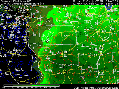
Staying in Norman, OK over the past week into this weekend. Gearing up for VORTEX2 & a potent local storm chase tomorrow. Oklahoma City NWS mentioning giant hail & tornadoes–not at all surprising considering the progged 7500 SBCAPE into tomorrow afternoon/evening with SBCIN almost completely eroded. Dewpoints pooling to upper-70s over a wide swath from DFW-Wichita Falls-southern OK.

Only concern is the almost total lack of helicity & rapid movement of the cold front (outflow dominant storms?). Mesoscale (storm-scale) interactions in such a strongly mixed atmosphere might be the only real hope for severe wx.
